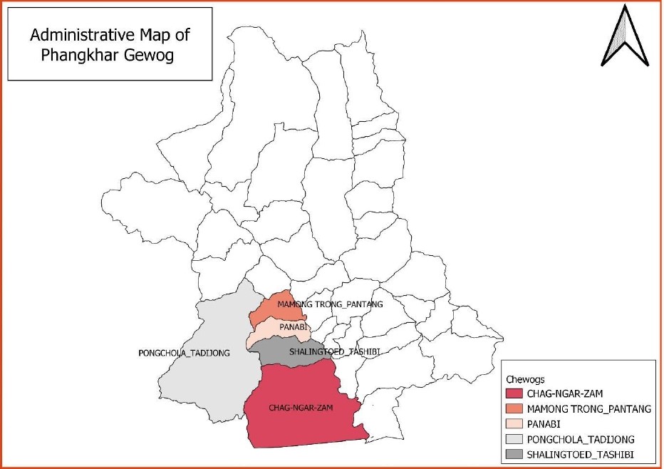
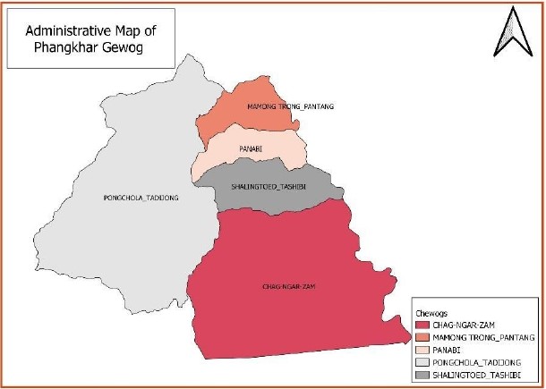
Discover Phangkhar Gewog in Zhemgang along the Gomphu–Panbang Highway—home to rich subtropical forests, vibrant farming communities, and eco-friendly initiatives. Experience authentic Bhutanese life and warm community hospitality amid pristine natural landscapes. The Gewog Centre is located approximately 90 km by road from the Dzongkhag Administration.
Phangkhar, Gewog at a Glance, 2023
The detailed information about the Gewog:
Area: 542.74 Sq Km
Population: 2612
Households: 211
Gungtong: 8
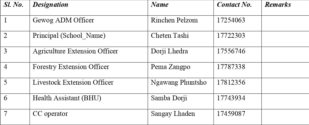
Local Government Officials:
Civil Servant:
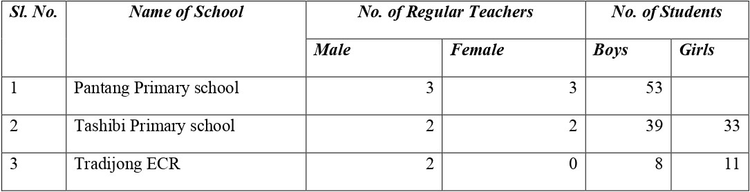
Education:
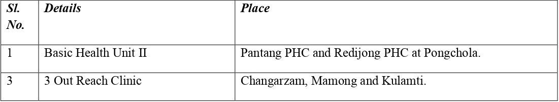
Health:
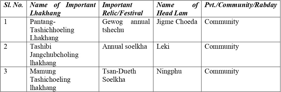
Lhakhang:
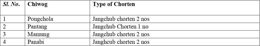
Chortens:
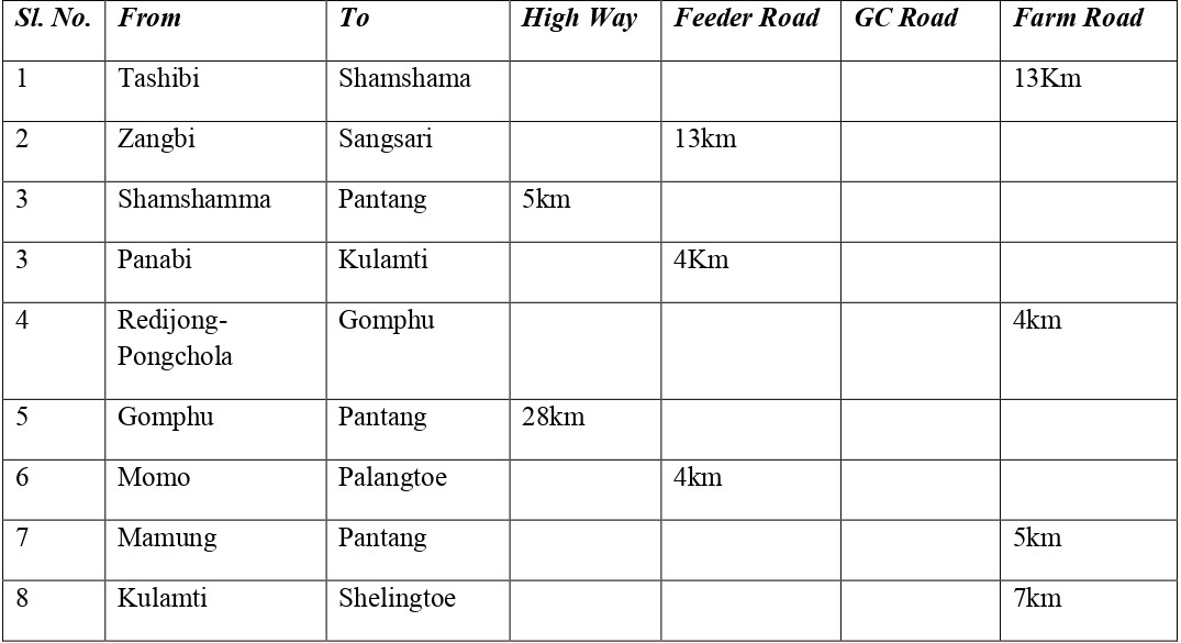
Road Connection:
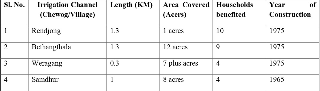
Irrigational Channels:
Electrical Fencing:
Economic Activities:
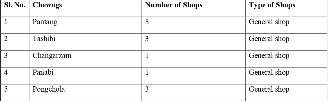
Business Activities:
RNRC: Agriculture, Forestry and Livestock Extension service are provided from the Gewog Centre.
Tele-communication: 100% coverage by both B-mobile and T-cell
Electricity: 100% connected
Compiled by: GAO ( Dechen Pelzom ) as of March, 2023